I draw cartoons for The Los Angeles Times about issues related to California and the Southland (metro Los Angeles).
This week:
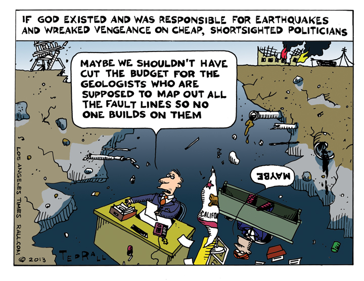
Angelenos try not to think about the shifting plates beneath their feet and their wheels, but everyone knows the Big One is coming — and a bad enough one is coming sooner than that.
Short of moving somewhere where tectonics aren’t quite as disconcerting (i.e., where it snows) there isn’t much we can do about earthquakes. But we can prepare for the worst by mitigating the damage.
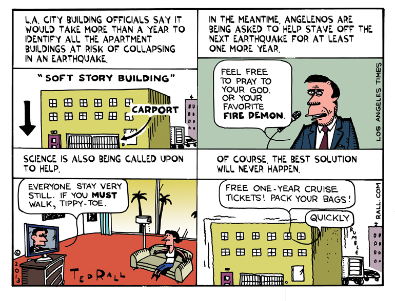
Toward that end, Los Angeles city building officials are creating a list of “soft story” wood-frame buildings that were built before 1978. “Soft-story structures often are built over carports and held up with slender columns, leaving the upper floors to crash into ground-floor apartments during shaking,” Rosanna Xia and Rong-Gong Lin II report in the Times.
There are probably about 6,000 of these buildings. The city says it will take at least a year to complete a list. After that, a retrofitting program will be put in place.
But what if an earthquake happens between now and then? It’s not like Mother (or, not to be sexist, Father) Nature waits for bureaucracy to work its magic.
Yeah, I’m a negative cuss.
So anyway, I began thinking about what, if anything, could be done to stave off the inevitable for at least a year — because the idea that this can wait another year is both horrible and amusing at the same time. How do these people think? Walk softly? Pray?
I know. They’re just civil servants trying to do their jobs with shrinking budgets and limited resources. But if, God or fire demon forbid, something bad happens before that retrofit project is finished, everyone is going look back and wonder why we didn’t throw money at it to get it done faster.